By Rich McKay
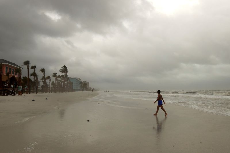
(Reuters) – Tropical Storm Debby is expected to rapidly strengthen into a hurricane before making landfall in the Big Bend region of Florida’s Gulf Coast by midday on Monday, the U.S. National Hurricane Center (NHC) said on Sunday, warning of potentially deadly storm surge.
As of 8 p.m. ET Sunday, sustained winds were 70 mph (112 km/h), just 4 mph away from being classified as a hurricane, and it is expected to strengthen overnight.
The hurricane center predicted life-threatening conditions, including storm surges of up to 10 feet (3 meters) in some areas. As it slowly moves northward through the week, the storm could bring “potentially historic rainfall” of 10 to 20 inches (25 to 50 centimeters) and catastrophic flooding to Georgia and South Carolina, it said. Local areas could receive 30 inches of rain by Friday morning, the report said.
“That’s going to be the story of this storm,” said Jamie Rhome, deputy director of the hurricane center. “Its retarder will dump historic amounts of rain, potentially over 20 inches. We’re talking catastrophic flooding.”
The storm could be compared to Hurricane Harvey, which made landfall in Corpus Christi, Texas, in August 2017. Although it was downgraded to a tropical storm as it moved inland, it remained over the state, dumping about 50 inches of rain on Houston.
Harvey is considered one of the wettest storms in U.S. history, causing more than 100 deaths and $125 billion in damage, mostly due to flooding in the Houston metropolitan area.
Rhome said Debby is being fed by the exceptionally warm waters of the Gulf.
Climate scientists believe that human-induced global warming, caused by the burning of fossil fuels, has raised the temperature of the oceans, making storms bigger and more devastating.
In preparation for Debby, Florida Gov. Ron DeSantis called out 3,000 National Guard troops and placed emergency orders in most cities and counties across the state, while mandatory evacuations were ordered in parts of the Gulf Coast counties of Citrus, Dixie, Franklin, Levy and Wakulla.
DeSantis said there are more than 17,000 electricians and other utility workers ready to restore power.
The governors of Georgia and South Carolina also declared states of emergency ahead of the storm.
HEAVY RAIN
Debby became a tropical storm Saturday evening. As of 8 p.m. ET, Debby was about 100 miles (160 km) west of Tampa and moving toward the Gulf Coast at 12 mph (19 km/h), with maximum sustained winds of 70 mph (110 km/h), the NHC said.
To become a hurricane, sustained winds must reach 120 km/h.
Debby’s center will move across the eastern Gulf of Mexico through Sunday and reach Florida’s Big Bend coast by midday Monday, the hurricane center added. Debby is then expected to move slowly across northern Florida and southern Georgia on Monday and Tuesday, it said.
The storm is expected to lose some strength after making landfall, but will bring heavy rain as it moves across central Florida to the Atlantic coast, before reaching Savannah, Georgia, and then continuing toward Charleston, South Carolina, early in the week.
Storm surge forecast for Bonita Beach, all the way north to Tampa Bay, could push waves farther inland than normal, damaging structures and endangering anyone in their path.
A hurricane warning is in effect for the Florida coast from Bonita Beach north to Longboat Key, including Charlotte Harbor, and a hurricane watch is in effect for the Florida coast from the Suwannee River to Yankeetown.
The last hurricane to make a direct hit in the Big Bend region was Hurricane Idalia, which briefly reached Category 4 strength before making landfall as a Category 3 in August 2023, with winds of over 125 mph. The National Centers for Environmental Information estimates damage at $3.5 billion.

Forecasters are predicting a large number of Atlantic hurricanes in the 2024 season, which began June 1, with four to seven considered major. That surpasses the record-breaking 2005 season that spawned the devastating Hurricanes Katrina and Rita.
Only one hurricane, Beryl, has formed in the Atlantic so far this year. The first Category 5 storm on record, it struck the Caribbean and Mexico’s Yucatan Peninsula before reaching the Texas Gulf Coast as a Category 1 storm, with sustained winds of up to 95 mph (153 km/h).


